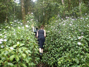
Hiking and climbing
Mount Kilimanjaro
Rising 5895m (19,340 feet) above sea level, Kilimanjaro is the tallest mountain in Africa and the world’s highest free-standing mountain. Kilimanjaro supports 5 major Eco-zones: rainforest, heath, moorland, alpine desert and glaciers.
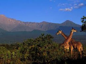
Mt. Kilimanjaro is one of the world's most accessible high summits, a beacon for visitors from around the world. Most climbers reach the crater rim with little more than a walking stick, proper clothing and determination. And those who reach Uhuru Peak, the actual summit, or Gillmans Point on the lip of the crater, will earn their climbing certificates, for their memories. There are six established routes to climb Mount Kilimanjaro - Marangu, Machame, Lemosho, Shira, Rongai and Umbwe. The Marangu, Machame, and Umbwe routes all approach from the south of the mountain (Mweka is used only for descent). The Lemosho and Shira routes approach from the west. The Rongai route approaches from the north. You should plan spending at least 6 days (5 nights) on the mountain (5 days on the Marangu Route if already acclimatized). This is a Kilimanjaro Park guideline. Mount Meru Meru is a great preparation hike for climbing Kilimanjaro, or a spectacular trek for those not compelled to do Kilimanjaro. You will hike past wildlife, the landscape is spectacular, and sunrise on the summit has Kilimanjaro as the backdrop. While typically done in only 4 days, it is not an easy peak to summit. To reach the top, there is some scrambling on rocks in the dark and at high altitude. You should be prepared for at least 10 hours of hiking on summit day. For an easier hike, you can climb just to Rhino Point for sunrise, and then descend. Mt. Oldonyo Lengai Size: height of 2,886 m/9,469 ft. Location: Northern Tanzania, 300 km (190 miles) Northwest of Arusha. Ol doinyo Lengai (pronounced ol doyn-yo len-guy) is an active volcano in the Eastern Rift Valley, and it is home to the Masai God Eng'ai, who signals her wrath with eruptions and drought. The name means 'Mountain of God' in the language of the Masai people who inhabit this area. Ol doinyo Lengai is a unique and extremely fascinating volcano that towers above the East African Rift Valley in Northern Tanzania, just south of Lake Natron. It is located on the way between Ngorongoro Crater and the Serengeti and is part of many of our itineraries. Geologists are particularly interested in Ol doinyo Lengai because It is the only volcano in the world that erupts natrocarbonatite lava, a highly fluid lava that contains almost no silicon. Oldoinyo Lengai is also the only active volcano in this part of the Rift Valley, though there are many older extinct volcanoes in this region. The mountain rises at startling 2,886 m/9,469 ft above the parched Rift Valley floor. Pare Mountains North Pare Mountains: The Northern Pare Mountains are situated 50 km south-east of Moshi, almost in the shade of Mount Kilimanjaro. The mountains can be entered via the town of Mwanga , the district capital where huge palm trees grow abundantly in the water that streams downhill. From Mwanga a good sand road winds upwards to Usangi, the center of the Northern Pare Mountains . Surrounded by eleven peaks, the little town is a center of economic activities. Small local factories produce bricks, stoves, pottery and clothes. In their backyards, some families have local breweries, using traditional brewing methods inherited from their grandfathers. Every Monday and Thursday, there is a colorful market, where farmers from the surrounding villages come to sell their harvest. The mountains are among the most fertile in East Africa , and villagers do there utmost to use every square meter of cultivatable land. Hand-made dikes have drained swampy areas, terrace-building has enabled cultivation on steep slopes and traditional irrigation systems bring water to many farms. On top of the mountains are protected natural forests and moor lands that often have the status of traditional clan-forest in the Pare culture. In these forests, ceremonies take place and witchdoctors perform their magic powers. From the mountain tops you have wide views over the surrounding plains, seeing the extensive Kisangara sisal estate, the long-drawn lakes of Jipe and Nyumba ya Mungu ("House of God") and at the horizon the Taita and Kiteto hills. Mount Kilimanjaro is a stone's throw from the area and at many places the impressive mountain is revealed for your eyes. South Pare Mountains: The Southern Pare Mountains are situated in Kilimanjaro Region, about 150 kilometers South of Moshi. From the surrounding plains, the mountains look like a barren and deserted area, but when you start climbing the slopes, one of Africa's most special landscapes is revealed for your eyes. Between huge desolate rocks lie small green river valleys where farmers have built impressive stone terraces. On top of the mountains is the Chome forest reserve, a dense tropical forest with many rare trees and plants. The forest offers an oasis of rest, beauty and fresh air. Visitors can easily walk a day through the forest without meeting anyone. The surrounding villages are among the most isolated places in Northern Tanzania and the local people have kept their traditional Pare culture throughout history. Narrow footpaths wind through the mountains from one village to another. A stay in the Southern Pare Mountains can perfectly be combined with a visit to the neighboring Mkomazi Game Reserve, where game drives and walking safaris are possible. You can choose different modules that vary from 2 to 5 days. In the two day visit you first climb up the Pare Mountains to Mhero village, where some farms and development projects can be visited. The next day you walk through the Chome Forest reserve from Mhero to Gonjanza. The three day module adds a day walking from Gonjanza to Mpinji, partly through the natural forest and partly through the cultivated southern slopes of the mountains, from where you have a beautiful view on the Usambara Mountains. On the way you can see the old river forest along the Saseni river. Usambara Mountains. |
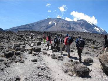
Mount Kilimanjaro, 5895m
Mount Meru, 4645m
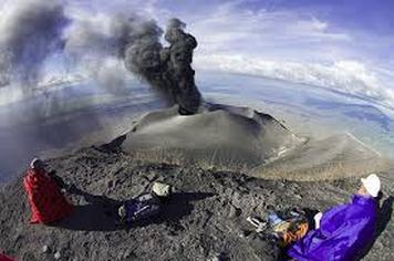
Mount Oldonyo Lengai. 2,886m
|
